 Must Do Climbs
by: John Summerson 5/15/2010
Slow and Steady Wins The Top
Slow and Steady Wins The Top
Personally I usually prefer short and steep climbing over variable grades to that of long and steady gradients. That type of climbing and grade variability just seems more interesting (or perhaps it is simply an innate desire to shorten the torture). However, most categorized climbs tend to be fairly long and over moderate and steady grade; climbs on which you can relax a bit and get into a pedaling rhythm. While generally not exotic this is the type of climb that you are more likely to encounter during a race or on a local ride. They are also a good place to learn to sit in the saddle and spin up the hill over distance.
Californians have the greatest assortment of road bike climbs to choose from in the entire country. From beyond category monsters in the Sierra Nevada Mountains to more moderate climbs along the coast and the shorter but generally steeper ascents in the Bay Area there are multiple rewarding climbs for all types of riders. The following climbs, one in each of four regions of the Golden State, are all challenging, long and generally steady grade and should be considered must do ascents for those looking to go seriously uphill on the bike. Regarding the rating listed; in major races climbs are rated numerically 1-4 dependent upon their length and grade with 4 as the least difficult classification. A hill considered more difficult than category 1 is described as hors or a beyond category climb.
Northern California
Cohasset Road
Total elevation - 2,900 ft | Length - 10.5 miles
Average grade - 5.2% (8%) | Rating - 1.54 (cat 1)
Cohasset Road is likely the most difficult ascent in the Chico area along a steady grade. Never steep, there is a bit of traffic at times but not enough to ruin a ride. Exposed down low, the upper section is a bit more variable and is shaded in places and the climb ends where the pavement ends. The fairly straight road makes for a pleasant descent as well.
Directions - From the junction of Route 99 and Cohasset Road in Chico head east on Cohasset for ~ 7 miles to Rock Creek Road on the left where the listed climb begins. Local start Nicalog Road is 1.2 miles further up the road on the right.
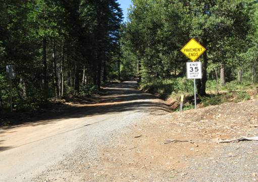
The very end of Cohasset Road near Chico
Central California
245/180
Total elevation - 4,711 ft | Length - 20.3 miles
Average grade - 4.4% (9%) | Rating - 2.22 (cat 1)
245/180 is a very long and scenic climb from the Sierra foothills up into very big trees. Route 245 is very twisty and over somewhat variable grade but nothing particularly steep and it has an isolated feel. Turn right at the intersection with Route 180 and continue on a steady grade and scenic stretch of road into Kings Canyon National Park. The climb ends at the junction of the road to Sequoia National Park.
Directions - From the small town of Woodlake in the central valley head north on Route 245. After ~12 miles Boyd Drive appears on the left. After another 6.6 rolling miles the grade increases as the road make a 90 degree turn to the right where the listed climb begins.
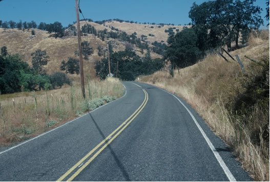
the start of the climb of Route 245/180 in Central California
Southern California
74 East
Total elevation - 3,741 ft | Length - 13.0 miles
Average grade - 5.5% (8%) | Rating - 2.08 (cat 1)
The east side of Route 74 is a long, twisty and scenic desert climb with a steady grade and an unmarked top. The 4 lane ends after several miles and it is here that the true nature of the climb is revealed along with great views of the valley floor. Over its middle section the road is a series of big s curves which are also fun to descend. The listed climb ends (unmarked) just beyond a viewpoint on the left. This can be a great winter climb and its lower half is hot in summer.
Directions - In Palm Desert, CA head to the corner of Route 74 and El Passeo where the climb begins by heading west on 4 lane 74.
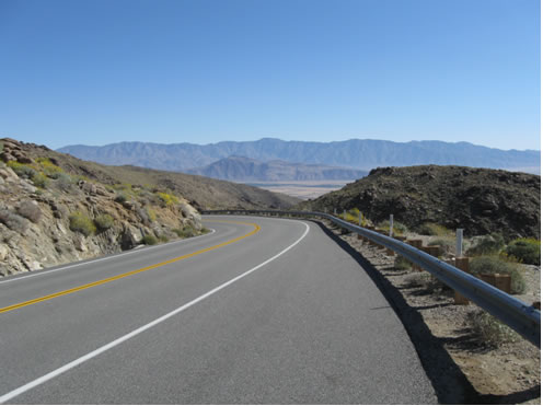
The scenic east side of Route 74 near Palm Springs
Bay Area
Mount Hamilton West
Total elevation - 3,956 ft | Length - 19.0 miles
Average grade - 3.9% (9%) | Rating - 1.59 (cat 1)
Mount Hamilton is a big climb with the greatest elevation change of any in the Bay Area. Essentially 2 separate ascents with a pretty big flat/descent in the middle, you will work to get to its scenic top. The initial climb is steady with views of the valley in places before you cross a saddle. Shortly afterward, the first hill crests and you descend into Grant County Park, passing the start of the east side of Quimby Road in the process. Shortly you begin to climb again up a twisty route. Another short descent occurs and then the final, classic (~6 miles at ~6% grade) section up to the observatory where the views more than compensate for the effort to get there.
Directions - in San Jose on I-680 exit to Alum Rock Avenue. Head east on Alum Rock for several miles to Kirk Road on the left. The listed climb begins here and you turn right on Mount Hamilton Road (on the right) soon after which takes you all the way to the top.
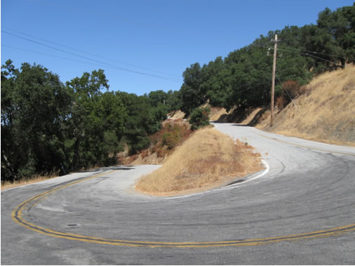
A switchback on Mount Hamilton
John can be reached at jsummers@wfubmc.edu