
 On The Road
by: Bill Oetinger 10/1/2009
The Provence-Alpes Tour
I've just returned from a cycle-touring vacation in France. It was a tour I dreamed up on my own, and eight of my friends accompanied me on the big adventure. As is the case with most of my bike tours, I will probably be mining this one for column fodder for months to come. At some point, I expect I will put together an extensive write-up on it at my own site, and when I do, I'll link you to it.
For now though, I am just going to give you a thumbnail account of where we went and what we encountered along the way. This is to set the stage and create some context for you in case I do ramble on in subsequent columns about various aspects of this trip. If you're a fan of the Tour de France, you will recognize the names of some of the famous cols we climbed (and descended). If you know the geography of the south of France, or if you've toured there yourself, you might be familiar with some of the other places we visited, including several scenic gorges.
We rode 14 stages over 16 days. Over those 14 stages, we accumulated a little over 900 miles and 103,000' of elevation gain. We had three stages under 50 miles and three over 80, with the average being about 65 miles and 7400' of gain a day. I don't know whether it's a universally embraced convention in the cycling world, but in my club and in our region, we use the benchmark of 100 feet-per-mile as the measure of a significantly hilly ride. By that standard, our entire tour qualifies as extremely hilly. In fact, the joke was made that we did our own Tour de France, only we distilled it down to just the mountain sections, leaving out all the flat and rolling miles...all the sprinters' stages.
The tour was confined to the southeastern corner of France: eastern Provence and the southern Alps. It looks like a tiny piece of real estate when seen in the larger context of all of France or all of the Alps, but it was jam-packed with cycling excitement, with eye-popping scenery, and with old-world culture and cuisine. We came to the tour with very high expectations, and I think I can safely say those expectations were met or exceeded on every single day we were there.
We began and ended the tour in the village of Villeneuve-Loubet, which is just a few kilometers northwest of the airport in Nice, right in the middle of the suburban stew that is the modern Riviera. Our plan was to stay in hotels along the way--booked ahead of the tour--and to move our luggage in a rented van, taking turns with the driving. In the end, one of our nine participants turned out to be a (mostly) non-cycling spouse who took on the task of driving the van each day, leaving the rest of us free to ride as much as we wanted to or could manage.
Here then is a brief list of our 14 stages and their chief points of interest.
Stage 1. Villeneuve-Loubet to Castellane:
55 miles, 6300' up, 4150' downChief challenges:
1. Gorge du Loup to Plan de Peyron: 3600' up in 20 miles
2. Col de Bleine (4720'): 900' up in 3 miles
3. Col de Saint Barnabé (4489'): 800' up in 2+ miles
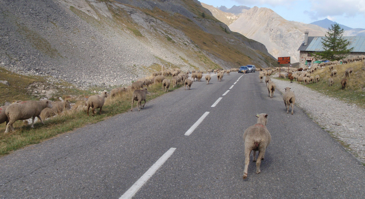
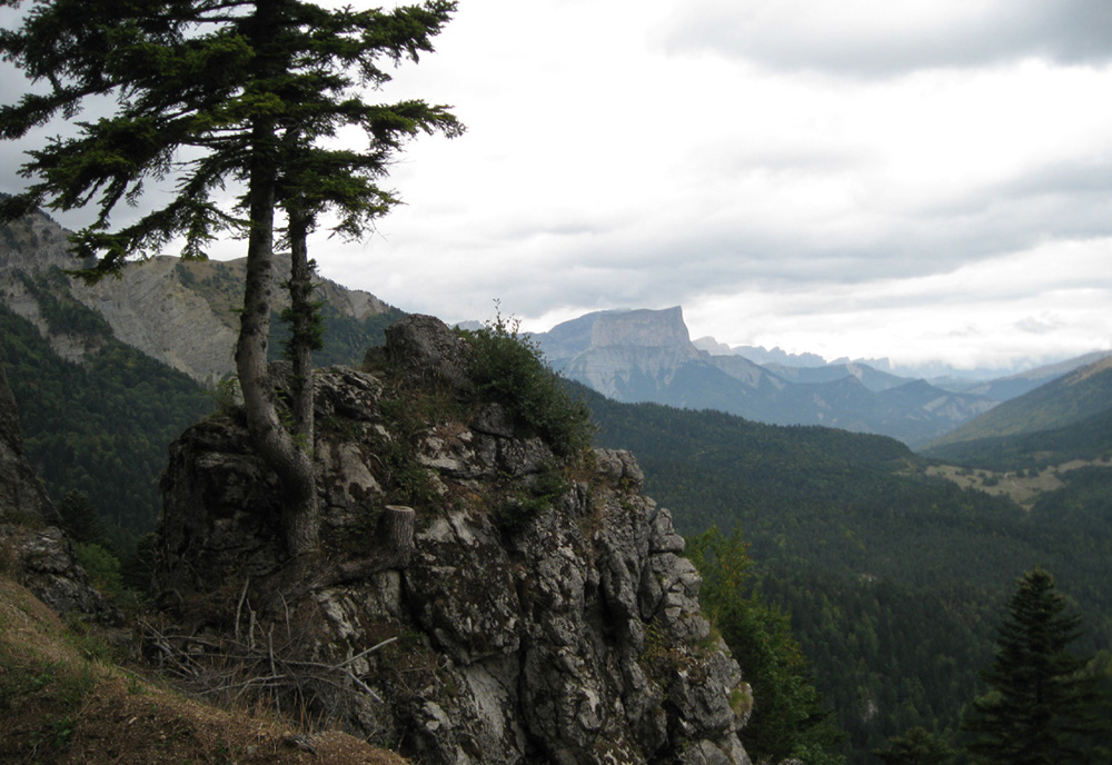
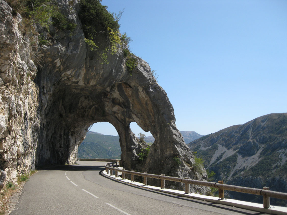 A lovely, sunny stage, climbing into the stony hills of Haut Provence. Fabulous scenery throughout, including the Gorges du Loup, Clue de Gréolieres, and Clue de Saint Auban, all fantasy landscapes of narrow canyons, waterfalls, natural arches, and cliff-hanging roads. Lots of climbing, but mostly quite easy, with nice descents to match. Our first exposure to “fast food,” a la Française: gourmet-quality salads served up in what would qualify as a funky greasy-spoon in this country: a modest little brasserie in the village of Saint Auban. Overnight for the next two nights at a delightful hotel in the pretty village of Castellane, serving up some of the best Provençal cuisine of the tour.
 Stage 2. Grand Canyon du Verdon Loop:
81 miles, 8500' up and down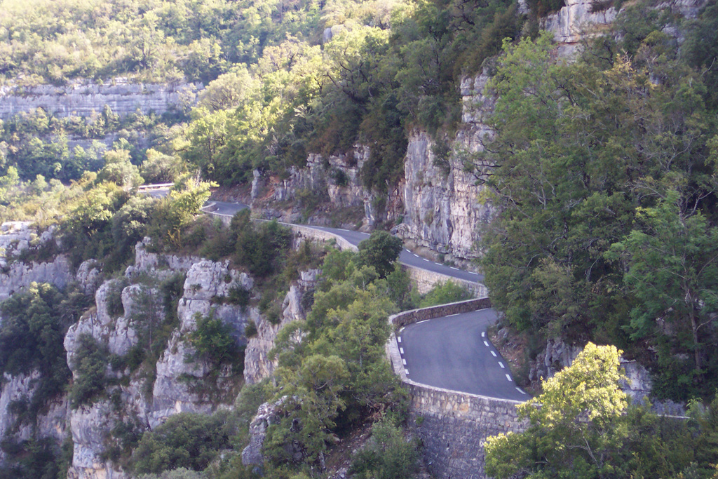 One of the most spectacular stages on this or any other tour. The deepest, largest canyon in Europe is almost too much to describe in a few sentences. Picture a cross between Yosemite Valley and Zion Narrows, with tiny, bike-friendly roads carved into the vertical cliff faces. We circumnavigated the canyon by way of roads on both the north and south rims, with occasional plunges right down into the bottom of the canyon, next to the unreal turquoise-colored water in the snowmelt Verdon River. By any measure, a world-class ride...an adventure of a lifetime. Big climbs and big descents all day long, most of them nameless and hard to quantify as individual cols, but collectively, enough to wear this cyclist out by the end of a long day. As hard as it all was though, it was worth it. Whatever else you do when visiting Provence, do not pass up the Grand Canyon of Verdon.
 Stage 3. Castellane to Barcelonnette:
73 miles, 8000' up, 6700' down1. Col de Toute Aures (3686'): 1325' up in 12 miles
2. Gorges de Daluis: 1550' up in 20 miles
3. Col de la Cayolle (7629'): 4250' up in 13 miles
 Today we left the hills of Provence and encountered our first real alpine pass of the tour, Col de la Cayolle, voted by French cycle-tourists as one of their favorite cols, and with good reason. But before that massive and beautiful climb and descent, we passed through the amazing Gorges de Daluis, a wildly sculptured rock garden looking like a transplant from southern Utah...another visit to the Highlight Zone. After a hearty pasta lunch, we headed for the Alps. Cayolle is a huge climb, usually with moderate grades but also with a few quite steep and painful pitches. The overall impact is profound: a very big, very impressive col. The scenery is lovely, every inch of the way. While the climb is open and expansive, the descent is tight and twisty, dropping into the Gorges du Bachelard, yet another narrow, rocky canyon crammed with waterfalls, stone bridges, and soaring cliffs.
Stage 4. Barcelonnette to Briançon:
64 miles, 8500' up, 7900' down1. Col du Vars (6914'): 2600' up in 9 miles
2. Col d'Izoard (7744'): 4200' up in 16 miles
 Vars and Izoard are often paired in Tour de France stages. These are epic cols and the stuff of racing legends. Vars alone is not all that difficult. It is only as a prelude to Izoard that it takes on epic status...the jabs to the body before the haymaker to the head that is the second peak. Vars does have an awesome descent, especially the lower section, which seems to go on forever. After a lunch in a sunny sidewalk bistro in Guillestre and the passage of Combe de Queyras, another extravagantly sculpted gorge, Izoard looms. This is probably the hardest, most brutal of all the climbs we did. 4200' up in 16 miles doesn't begin to describe how tough it is. Loads of sections in double digits...painful for way longer than seems fair. There is a monument to Fausto Coppi and Louison Bobet at le Casse Déserte, a barren scree slope near the summit. But even here, so near the top, there are more tough, steep pitches before the pass is finally reached. It really messes with your head: how long can this go on? The descent is just as long and just as steep as the climb. The upper reaches are almost too steep to let it rip. As I tiptoed down the mountain, I thought of the pros climbing this monster, then bombing down this perilous chute at 50 or 60-plus, dinking and diving toward a finish in Briançon. My hat is off to them! We spent two nights at a charming swiss-chalet style hotel in the ancient village, one night after this magnificent stage and one after a rest day spent exploring the wonderful old, fortified village on its hilltop above the valley.
Stage 5. Briançon to St. Jean-de-Maurienne:
55 miles, 6000' up, 8500' down1. Col du Lautaret (6746'): 2800' in 17 miles
2. Col du Galibier (8669'): 1900' in 5 miles
3. Col de Télégraphe (5136'): 550' up in 3 miles
 The Télégraphe-Galibier climb, taken from north to south, is one of the most daunting, difficult ascents in Tour de France lore. But taken from south to north, as we did it, with the long, lazy grade of Lautaret preceding Galibier, it becomes almost a pussycat of a climb. 8669' Galibier was the high point of our tour, so we expected a stiff challenge. But in fact, we nearly danced up it, with loads of energy left over for admiring the high alpine scenery on all sides: snow-capped peaks and glaciers in the high valleys. The descents off the north sides of both Galibier and Télégraphe were endlessly entertaining...mile after mile of twisting, slinky fun. After the brutal punishment of Izoard, this relatively easy day was a pleasant surprise and a big relief.
Stage 6. St. Jean-de-Maurienne to Bourg-d'Oisans:
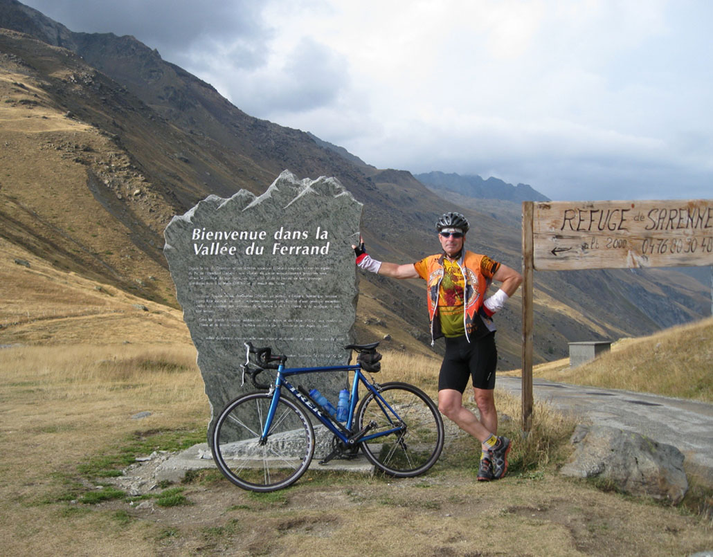
80 miles, 14,000' up, 13,500' down1. Col du Mollard (5346'): 3400' up in 10.5 miles
2. Col de la Croix de Fer (6783'): 2820' up in 9 miles
3. Climb from Eau d'Olle: 350' up in 1 mile
4. l'Alpe-d'Huez (5904') via D211B: 3200' up in 10 miles
5. Col de Sarennes (6560'): 1050' up in 5 miles
6. Climb from Freney to D211A: approx 1000' up in 10 miles
 This turned into our toughest stage, a ridiculously hilly ride that slapped us all around and used up all our daylight. We did not intend to begin with Col du Mollard, but construction on the lower slopes of Croix de Fer forced us to add this extra, very substantial detour at the start. It's a delightful road, with great views from its higher sections, but we really didn't need to make this hard stage any harder. The upper reaches of Croix de Fer--the part we did--are not too difficult, although the grade up through the village of St. Sorlin-d'Arves is up into double digits. We caught a few sprinkles on this famous summit, so after quickly snapping our pix with the iron cross, we dove down the far side, headed for Alpe-d'Huez. Our approach to the iconic Alpe was unconventional, sneaking up on the famous road from the side, via the balcony road D211B. With 3200' of gain in ten miles, this is a substantial ascent, although a bit less steep than the traditional approach up the 21 hairpins. The town of l'Alpe-d'Huez is a trashy ski station. It is tacky in the extreme, with absolutely no redeeming scenic or cultural value. We fled the town without taking a single photo, heading further uphill for the Col de Sarennes, one of the most primitive, remote, and sketchy of all paved roads in the Alps...a real walk on the wild side. After the long, tortured descent from Sarennes, we had one last, somewhat unexpected challenge to tackle: the climb from the valley floor back up to our second balcony road: D211A. (Balcony roads are hair-raising lanes cut into the sides of sheer cliffs.) We were expecting some climbing, but the length and severity of this pitch, especially at the end of such a hard day, was a rude surprise. It really wore us down. By the time we finally made it up to this famous cliff-hanger of a road, we were too tired and too rushed for daylight to really appreciate it. One way or another, we had bitten off a bit more than we could chew on this day. We did it, but I don't think we had as much fun as we expected to. We were just too trashed and too rushed at the end.
Stage 7. Bourg-d'Oisans to Villard-de-Lans:
88 miles, 10,200' up, 9200' down1. Col d'Ornon (4503'): 2100' up in 7 miles
2. Many climbs along the Corniche du Drac
3. Col de Saint Nizier (3831'): 3100' in 8 miles
 Here again, the stage proved to be much more difficult than we had anticipated it would be. Tricky navigation on some very obscure little roads caused us to make a few wrong turns, bumping our miles from 80 to 88 and adding quite a bit of extra climbing as well. (One of our wrong turns did expose us to a thrilling exhibition of bungee jumping from a dizzyingly high bridge: the Pont de Ponsonas.) What we had expected to be a rolling run along the rim of the Corniche du Drac, overlooking a magnificent lake, turned into an endless series of steep, exhausting ups and downs. And while Col d'Ornon had seemed an easy, gentle climb early in the ride, Col de St. Nizier, late in the day, was a tedious, never-ending slog, its only consolation being the splendid views over the big city of Grenoble. We burned up all our daylight and most of our energy on this one and found ourselves having dinner very late in the evening, and fortunate to even find a restaurant open at that hour.
Stage 8. Villard-de-Lans to Die:
73 miles, 7800' up, 9800' down1. Detour climb through Valchevriére: 1400' up in 7 miles
2. Col de la Machine (3316'): 2500' up in 8 miles
3. Font d'Urle (4694'): 1100' up in 5 miles
4. Col de St. Alexis/Rousset (4483'): 1000' up in 6 miles
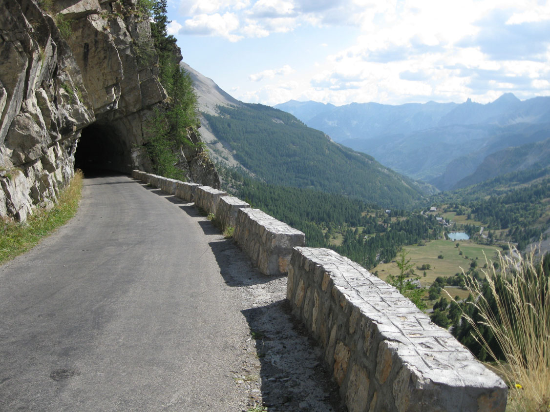
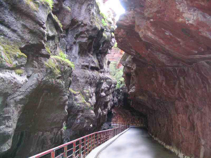
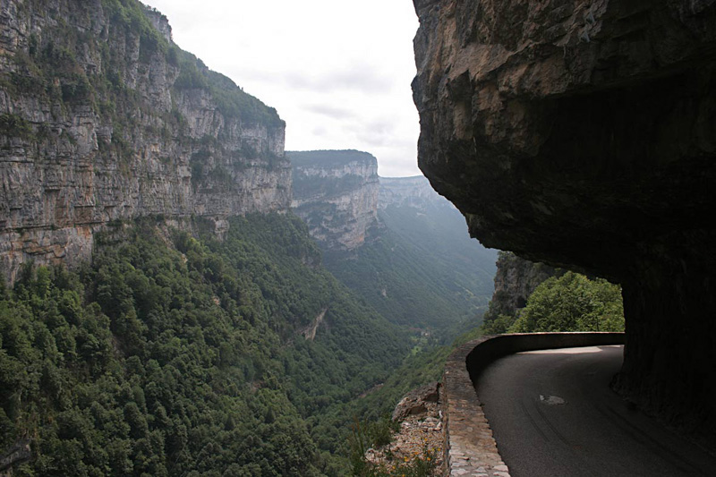 A visit to the Vercors, a mountainous region famous for off-the-chart beauty and for its tiny roads cut into sheer cliffs. Another road closure for construction cheated us out of part of the spectacular Gorges de la Bourne and forced us to make a long, hilly detour to start the ride. The good news is the detour was beautiful and almost as spectacular as what we missed, and besides, we still got to see most of famous Gorge, with its cliff-hanging, tunneling road. We had lunch in the quaint village of Pont-en-Royans before tackling the long climb to Col de la Machine and Combe Laval, another amazing rock-candy confection, with the road etched into the face of towering cliffs...tunnels, natural arches, and standing stones galore. More modest climbs in the forest after the big-rock extravaganza, and finally, the long, switchbacking descent from Col de Rousset to end the day. Only problem with this huge downhill: the notorious Mistral, a bitterly cold, fierce wind, knocking us about all the way down the hill, making what should have been a wild descent just a little too wild.
Stage 9. Die to Corps:
60 miles, 6500' up, 4800' down1. Col de Menée (4598'): 2500' up in 9 miles
2. Col St. Sebastien (3037'): 600' up in 3 miles
3. Assorted smaller climbs approaching Corps
 The cold wind of the previous day turned to cold rain late in the stage on this otherwise relatively moderate ride. It was overcast but dry until we crossed the summit of beautiful, peaceful Col de Menée at mid-ride, but after that, the showers chased us all the way to the finish. Some comfort was provided by the nice folks in a little cafe in Clelles, who warmed us up with a generous helping of beef stew, pomme-frites, and hot café au chocolat. But the effects of that midday lunch had worn off by the time we climbed the last, steep pitch to Corps and the Hotel de la Poste. We were cold, wet, and miserable. However, after hot showers and fluffy towels, we were ready for one of the highlights of our trip: an unbelievable gourmet dinner from chef Gilbert Delas, a famed master of French gastronomy...a four-hour, multiple-course culinary performance that left us gasping, wheezing, and applauding when we finally staggered off to bed at midnight. This was a meal for the ages. Haute Cuisine at its finest, and all at a very reasonable price, in a little village in the middle of nowhere.
 Stage 10. Corps to Savines-le-Lac:
46 miles, 5200' up, 5600' down1. Col de Moissiere (5159'): 1700' up in 7 miles
2. Côte de St. Apollinaire (4198'): 1360' up in 5 miles
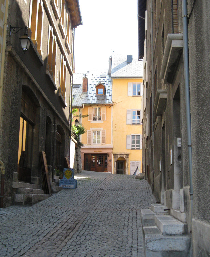
 The threat of more rain prompted us to insert the only shortcut of the tour on this day, bypassing high, hard Col du Noyer for an easier run along a nearby valley. That cut out 20 miles and some very substantial climbing. In the end, it never did rain, so we probably could have done it. But while my head regretted missing the big col, my legs at least appreciated the easier day. We still had the two big (and beautiful) climbs listed above and many smaller ones, as we worked our way through the mountains above Lac de Serre-Ponçon and the city of Gap. We had scheduled two nights in our hotel in Savines-le-Lac, incorporating our second rest day. Turns out Savines-le-Lac is a modern town--a subdivision--with not one structure in the place older than about 1970. It was the only such community we encountered on the trip. As it was bland and boring, we piled into our van on our rest day and drove to both Embrun and Gap, two nearby towns with charming, historic downtowns, where we wiled away the day on sightseeing and long, lazy lunches in sunny sidewalk cafes. Were I to do this tour over again, I would adjust the routes for overnights in Embrun, about five miles beyond Savines-le-Lac.
Stage 11. Savines-le-Lac to Allos:
48 miles, 6600' up, 4600' down1. Savines-le-Lac to le Sauze: 800' up in 8 miles
2. Col d'Allos (7347'): 3700' up in 12 miles
 After our sunny rest day, this morning dawned bright and clear, with the promise of great riding weather for our attack on Col d'Allos, a famously fearsome Tour de France summit. So much for promises! The first half of the ride was dry, along Lac de Serre-Poncon and up into the valley of the lovely Ubaye River. But just about the time we hit the base of the climb to Allos, it started to rain. 12 miles up to the summit and another 10 down the other side might not seem like many miles, but when you're soaked to the skin and frozen to the bone, it seems like an eternity. (It was 40° at the summit, prompting us to change the name of the pass from Col d'Allos to Cold Allos.) The climb was a slow form of water torture, but the descent was worse, with the wind chill added to the equation, and with super-steep, cliff-hanging hairpins to negotiate with wet rims and numb fingers on the brake levers...an icy torment lasting most of an hour. But again, as after our other wet ride, we were revived by the kindness of our hotel staff, in this case, a look-alike mother and teen-age daughter--all pink and plump and swiss-miss--who cooked up a hearty dinner of raclette (swiss cheese melted over potatoes and baguettes).
Stage 12. Allos to Entrevaux:
68 miles, 6600' up, 9600' down1. Col des Champs (6845'): 2800' up in 7.5 miles
2. Guillaumes-Peone-Valberg: 2900' up in 9 miles
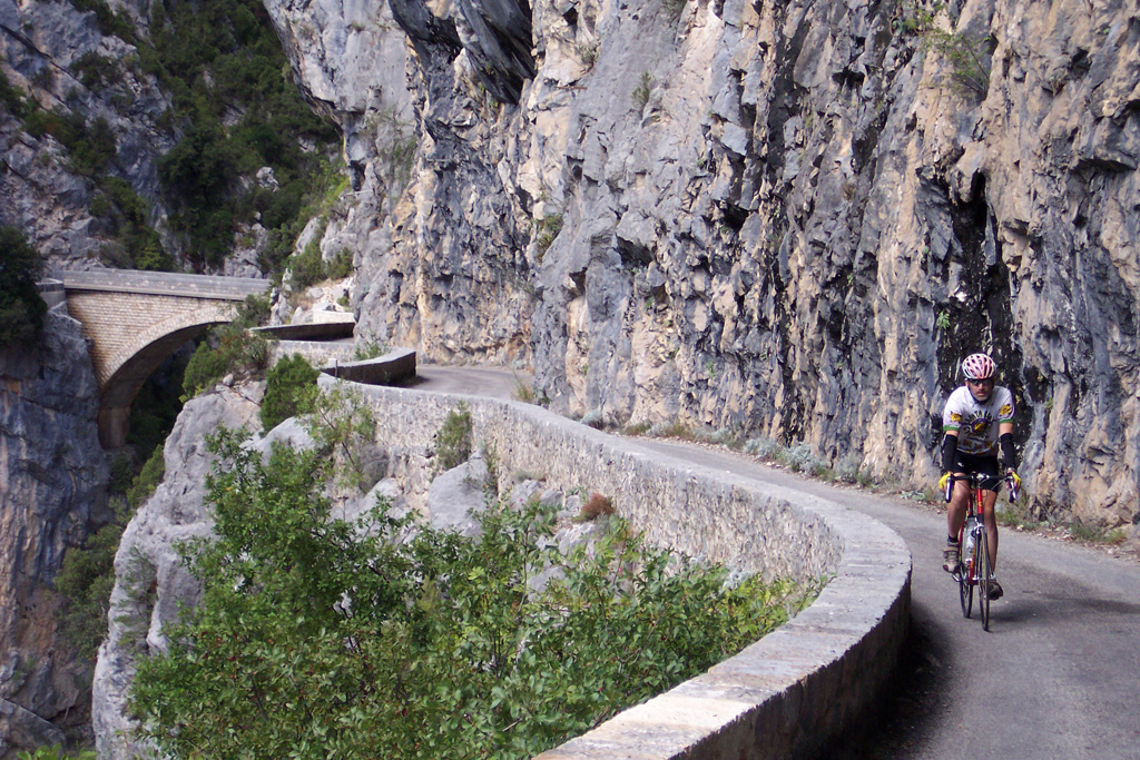
 This great stage looked to be one of the most epic and interesting of the whole tour. But the previous day's rain had us a bit gun-shy as we set out: the skies still looked ominous. We hoped for the best but prepared for the worst by packing our pockets and seat bags with every bit of foul-weather gear we owned. Fortunately, the capricious rains held off again, and we got the ride done dry. We began with our last big alpine summit, Col des Champs, which turned out to be a relatively easy climb, almost all of it in deep forest, only breaking out above the timberline in the last kilometer. Pavement on the climb was very old and rough, but just over the summit, the downhill took on brand new, satin-smooth paving, still inky black, for the nearly 17-miles of wild descending that followed. Then we had the long, steady, and very pretty climb to Valberg, passing through the charming, remote village of Peone along the way. After a lunch in the ski station at the summit, we had one more treat in store, and it has to be one of the highlights of the trip: the downhill plunge through the redrock wonderland of Gorges du Cians. The road was closed to cars because of landslides in the gorge, but we jumped the barricade and rode on through, with the whole road to ourselves. (It was Saturday, so no road crews were there to hassle us.) Cians is simply amazing: an upper gorge that is a narrow slot canyon as contorted and twisted as anything in the American southwest, with the tiny road shoehorned into the cavern-like canyon anywhere it will fit; then a lower gorge that is more open but with cliffs on either side soaring to nearly 3000' above the road. And amidst all that breathtaking scenery, a downhill of over 3200' in 13 miles. As if all that weren't enough, we spent the night in the village of Entrevaux, one of France's best preserved and most hallowed medieval hill villages...and for a change, we had enough time and energy in hand to thoroughly explore this precious gem of a community, both before and after our nice dinner.
Stage 13. Entrevaux to Villeneuve-Loubet:
68 miles, 5500' up, 7000' down1. Col de Saint Raphael (2870'): 1525' up in 4 miles
2. Roquestron to Conségudes: 1000' up in 6 miles
 What we had assumed would be a nothing-special ride back into the suburbs around the Riviera turned out to be one of nicest rides of the tour. No big-name cols or famous attractions anywhere, but quiet, bike-friendly roads throughout, all beautiful and all fun for riding, with easy climbs and ripper descents. Clue de Riolan and Clue d'Aiglun provided more of that slot-canyon, rock-candy scenery we had come to know so well, and humble, anonymous Hwy D1 was sensational, running along the rim of a vast, deep gorge, with views to forever. (I had read that it was a nice road, but this nice? Who knew?) We finished up with a meandering exploration of obscure roads that did a good job of avoiding the worst of the clutter around the towns crowded together in the hills above the coast. I had worked out an extremely convoluted route to accomplish this, with the help of Google StreetView, and it worked.
Stage 14. Monte Carlo loop:
46 miles, 3300' up and down1. Monte Carlo harbor to the Grande Corniche: 1700' up in 6 miles
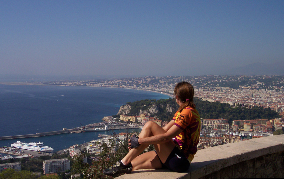 This had been planned as our Prologue ride to begin the tour, but airline delays forced us to skip it at the beginning. On our last day, we managed to squeeze it in as an Epilogue. I had always wanted to see the seaside resorts of the Riviera, especially Monte Carlo, and this ride gave me the chance to cross that off my life list. The ride has its charms, but overall, I wouldn't rate the experience very highly. Those high-roller resorts appeal to a certain class of people--the extremely rich or those wishing they were--but they don't offer much for the rest of us. The cycling is decent, but very congested and confusing, and the tourists are as thick as fleas on an old dog. We were happy to escape to the Grande Corniche, the lovely, quiet road running along the hillside above all the busy glitz and congestion.
So there you go: our big adventure in the South of France. My body is still getting over all those big climbs. (In spite of all the great food, I lost weight on the tour.) And my mind is still digesting all the sights and impressions, which may or may not resurface in this space at some future time as observations about life and cycling in France. The trip was a long time in the planning stages...a long-simmering dream for me before it finally, actually happened. It will now take a long time for all the experiences to settle out in my memory banks, as we pore over the thousands of photos we collected on our little chips.
I hope this list of place names makes some sense to those of you who have not been there...doesn't just make your eyes glaze over. If you've ever imagined yourself touring in this region, you could do a lot worse than follow this route, and I would be happy to pass along to you any maps or other support material and advice I collected along the way.
Bill can be reached at srccride@sonic.net