
 On The Road
by: Bill Oetinger 2/1/2002
Messing about with maps
Here's a nice winter topic: maps. When snow piles 'round the door, or rain pelts at the windowpane; when only highly motivated miles junkies are outside braving the elements.... that's the time to curl up in front of the fire with a good map, or better yet, a whole lap full of good maps. If I can't be out riding my bike, my next favorite bike-related activity is planning rides I'll do at some future, sunnier date. And all route planning starts with maps.
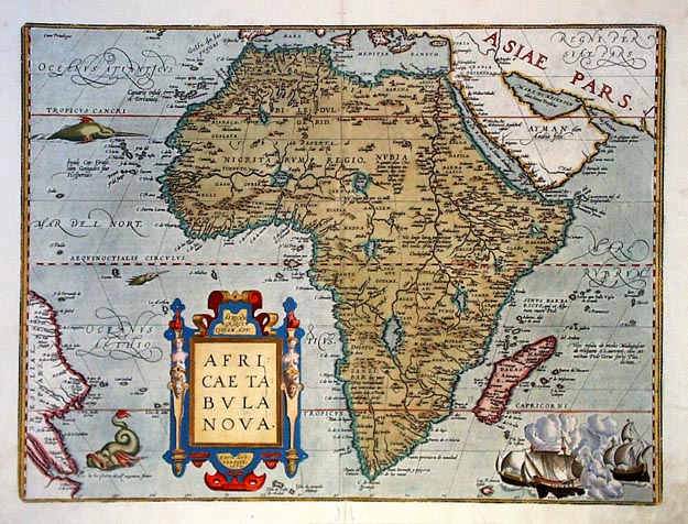 I'm a certifiable map nut. A cartophile. In fact, I love any images that look down on the world and lay it out as if it were a model train set. Not only maps, but also those wonderful photos taken from planes and satellites. I have coffee table books full of those pictures, plus several big atlases, hundreds of National Geogrpaphic maps, and boxes bursting at the seams with more road maps than any sane person ought to own. But now that I think about it, I guess there are some maps that don't capture my imagination. I understand there is a huge market for fancy, antique maps....the great old works of Mercator and Ortelius and others from the Age of Discovery, embellished with dragons and mermaids and other whimsies. Very collectable these days, and very pricey. I appreciate that they're beautiful, and that they represent pivotal moments in history, but they interest me only about as much as any other historical artifacts interest me. What I really prize in maps is accuracy. Contemporary, up-to-date information, presented in voluminous, precise detail. If the map is nicely crafted and pleasing to look at, so much the better, but the first priority for planning bike rides is a clear, clean reflection of reality.
I don't need maps to plan my weekly rides in my own backyard. The roads of a four or five county region around my home are pretty much hardwired into my brain by now. But I plan and lead a lot of bike tours in other regions, far afield, and these all begin as journeys to Terra Incognita. Voyages of discovery into the unkown.
 Usually, by the time I settle down with a lap full of maps, I already have a pretty good idea of where I want my tour route to go. I will have somehow arrived at the conclusion that such and such an area is cycle-friendly. Magazine articles I've read; travel shows I've watched; conversations with other riders; etc. I stow it all away in my flypaper memory and dredge it up as needed at a later date. Once I have the general, regional outlines of a tour in mind, out come the maps, and this is where the fun begins....
When Robert Louis Stevenson began work on his novel Treasure Island, the first thing he did was draw a map of the island at the center of the story. Before he even had an outline of the plot or a cast of characters, he began doodling a map. And as he filled in the many blank spots on the sheet of paper, the story began to emerge, as if conjured up by the spaces and places. As he recalled later: "As I pored upon my map of Treasure Island, the future characters of the book began to appear there visibly among imaginary woods; and their brown faces and bright weapons peeped out upon me from unexpected quarters...on these few square inches of a flat projection."
Such is the magic of maps: their ability to create in our minds a substantial, three dimensional world of solid objects and complex landscapes, all spun into cloth from the thin threads of words and wiggly lines deployed over a flat page. When I sit down with a map of a faraway place--a place where I plan to ride--what I hope the map will do is yield up quantities of information that will allow me to build a picture of the place....to see the roads, the hills, the rivers, the campgrounds, almost as if I were really there.
There are certain qualities I rate highly when planning a bike route: great scenery; light traffic; interesting terrain (yielding challenging climbs and entertaining descents); good campgrounds at convenient intervals; decent pavement, etc. Extracting all these details from maps provides me with hours of enjoyment and mental exercise. I dive so deeply into the reflected reality of the map world that I am almost transported out of my current time and space, much as one is when absorbed in a good book. I find the exercise intensely relaxing, if that doesn't sound too oxymoronic.
My first order of business when laying out a ride is to come up with the appropriate distance to be traveled. I aim for a ride of around 65 miles with, if possible, a shortcut that will drop the distance to 50 or 55, and a longer option that might add ten or more miles. That way, when we do our tour, there will be options to suit lots of different riders. So the first thing I ask the map to tell me is miles. Many maps don't list miles at all, and some only break the miles out in big chunks. I'm always happiest with the maps that have distance breakouts at just about every little side road and summit and driveway on the map. (More about the modern CD mapping programs later.)
Obviously, route miles are always contingent on getting from point A to point B, so finding appropriate campsites in the right places is a big factor in how the miles add up. (Most of the tours I plan involve camping between stages, but some are laid out to towns with inns or motels. These and other different approaches to multi-day touring is a subject I may address in another column, but not today.) Using supplemental campground maps and guide books helps to locate good camps with better amenities, such as showers or swimming pools or swimming holes. This is an area where a map being out of date can be a significant problem, as formerly primitive campgrounds are upgraded with the addition of showers, for example. Prowling the internet has become a useful supplement to my maps and guidebooks in this respect.
Road surface quality, traffic load, and gradients are not so easy to figure, and require an almost intuitive reading of the map's little clues. Later on, I will talk about the quality of maps provided by different publishers, and that will address the road surface question somewhat. Traffic load can be estimated from the line weight used to draw a particular highway, but can also be inferred from the windiness of the road--more curves equals less traffic--and whether the road connects population centers or is in the middle of nowhere. Figuring out uphills and downhills is great fun. A few maps publish gradient chevrons, which are obviously very helpful (although not always accurate, in my experience). Many more maps show elevations of towns, lakes, and summits, so you can extrapolate from those fixed points and fixed heights. Where none of those exist, or in long stretches between them, rivers can be helpful indicators: heading toward a river crossing is usually downhill; away is uphill; riding alongside a downstream flow is downhill; etc. As I note later, the new computer mapping software can do all this calculating for you in a few seconds, but there are some problems with all that technology too. Not to mention that--for me anyway--it isn't as much fun as handling and poring over a nice map.
Don't get me wrong about technology though: I'm no Luddite on this subject. Not only do I study maps, I make maps of my own. I'm a commercial illustrator, and for my various tours, I have created hundreds of maps, all of them drawn in the computer (in either Freehand or Illustrator). I love what the technology can do for production of a map. But at the same time, from an aesthetic and recreational point of view, I still enjoy the finished product--on paper, in my hands--more than what I see on the screen.
![]() If you are still reading this column, you're probably--like me--one of the world's map people. I have found, over the course of leading hundreds of rides, that some people tend to relate well to maps, while others just don't go there. We hear people say they have a poor sense of direction, or that they could get lost in their own bathroom. I wonder if this tendency is a learned behavior, an inherited condition, an attitudinal pose, or what? Do their brains just not work in the spatial way that makes maps come alive? Is having--or professing to have--a poor sense of direction the same thing as not being able to read or understand a map, or not being interested in reading or understanding a map? I don't know, but it would be safe to say they're connected at some level.
If you are still reading this column, you're probably--like me--one of the world's map people. I have found, over the course of leading hundreds of rides, that some people tend to relate well to maps, while others just don't go there. We hear people say they have a poor sense of direction, or that they could get lost in their own bathroom. I wonder if this tendency is a learned behavior, an inherited condition, an attitudinal pose, or what? Do their brains just not work in the spatial way that makes maps come alive? Is having--or professing to have--a poor sense of direction the same thing as not being able to read or understand a map, or not being interested in reading or understanding a map? I don't know, but it would be safe to say they're connected at some level.
I know some cyclists who derive no pleasure from looking at a map, even a map of a ride they're going to do that very day. They say, "I don't care where we're going: just wind me up and point me in the right direction. Anyway, I don't need to know where I'm going cuz I'm riding with you!" This always amazes me. If I haven't studied the map of my route ahead of time, I feel at a distinct disadvantage. If I don't know where the big hills are or how long the ride is, how will I meter out my reserves? I like to know where I can get water or food, where the scenic attractions are, and so on. To not have at least a minimal interest in these matters seems bizarre to me, but I have come to accept that a lot of people couldn't care less.
On the other end of the spectrum are people like me, and perhaps you, who derive a great deal of pleasure, as well as hard information, from maps. And it doesn't much matter whether the map is for today's ride or for a ride that might happen years from now. It's simply a great mental recreation to process those little bits of map graphics and form them in our mind's eye into a real, tangible world. It's as if you had taken your dry ingredients, added water, put the whole thing in the oven, and then watched as the flat, two-dimensional map had risen up into a complicated, three-dimensional soufflé of mountains and valleys, meadows and lakes, and little winding roads.
I'm going to go on here at some length about different kinds of maps that are currently available. Sort of a consumer review of the options. If you're interested, read on....
By far, the most comprehensive collection of road maps for the state is produced by the California State Automobile Association, commonly called "AAA" or "Triple-A" (after the parent organization, the American Automobile Association). They crank out hundreds of quality maps, not only of the state as a whole, but of counties, cities, and regions, at a scale that works very well for cyclists. They're clear and easy to read, very informative, and generally--although not absolutely--accurate. My only real complaint about them is that they have this designation for many backroads, "Surface not indicated." These are often the little roads that interest cyclists most, but you can't tell from the map whether they're gravel or smooth blacktop. It's a serious failing, from a bicyclist's point of view.
Sadly, Triple-A appears to be eliminating or cutting back on the numbers of highly detailed local maps....those that focus on one or two counties. These nice maps are being replaced by huge, regional maps, which are still good, but sometimes lack the intense local detail.
Some of the maps covering the southern half of the state are produced under the auspices of the Automobile Club of Southern California and have a very different graphic appearance than the ones for the rest of the state. Compared to the standard AAA maps, I initially found them a bit messy looking, but I've come to appreciate that all that messiness is actually a dense mass of detail that you won't find on other AAA maps. In particular, they have more detail of a sort that cyclists will find useful. Their mileage readings are more accurate, or at least are broken into smaller increments--from one intersection to the next--so that one can more precisely measure a route. They also point out many summits on hilly roads and list their elevation....a very salient stat for bikers. Their campground listings are more detailed as well. Most importantly, they do away with the frustrating "Surface not indicated" tag and replace it with a whole range of discrete variations: Paved, Gravel, Graded Dirt, Dirt, etc.
To acquire CSAA maps you must be a member of the organization. Dues currently run about $60 a year. Being a member entitles you to far more services than just an unlimited supply of free maps, although you could walk off with $60 worth of maps without even trying and not begin to scratch the surface of what they have available. Aside from the maps, perhaps the items they offer that are of most interest to cycle-tourists are their TourBook and CampBook, encyclopedic guidebooks to motels, inns, and campgrounds throughout the state. In addition to these guidebooks, they offer maps devoted entirely to listing and describing every single campsite in the state. (They do miss a few campsites, but not too many.) Maps and guide books are available for other states as well. They have over 75 offices around the state where you can drop by and collect maps, or they will mail them to you. All in all, it's a very good deal, and if you're planning on doing much cycle-touring (or auto-touring, for that matter), I think it's money well-spent. For more information, call your local CSAA office or, if you're out of state, track down the affiliated AAA office near you.
* Over-the-counter maps
There are several companies producing maps for the over-the-counter market in service stations and convenience stores, and among these, I find the maps produced by Compass to be among the best. They're usually of one or two counties at a time and often contain very detailed insets for cities and towns in that area. In many cases, they have more detail than regional AAA maps, although they don't show mileage or elevation numbers. I wouldn't be happy using just Compass maps for detailed tour planning, but I find them helpful as supplements to the AAA maps, filling in little gaps that the other maps might have missed. For more information: 209-529-5017, or PO Box 4369, Modesto, CA 95352.
* Krebs Cycle Products
The maps produced by Richard Krebs claim to be "The World's Best Bicycle Maps," and they may be, although I have a few minor quibbles with them. As maps designed specifically for bikes, they have numerous advantages over auto-club maps: they include very good elevation profiles, and the roads are marked with climbing chevrons indicating where the hills are and how steep they are. They offer numerous notes in the margins on local conditions, points of interest, accommodations and eateries...even bike shops and sources of water. I have found these notes to be generally accurate and helpful.
My complaints: sometimes roads have been omitted that the mapmaker felt weren't important, but which I would like to know about; their inventory of maps doesn't comprehensively cover the state (yet); the maps are hand-drawn and hand-lettered, which sometimes leaves me in awe of the painstaking handwork that went into them, but also often leaves me wishing for crisper, less funky graphics. However, these are minor quibbles, and if you can find a Krebs map that covers the area you're visiting, I recommend it. For more information: PO Box 7337, Santa Cruz, California 95061.
* U.S. Forest Service maps
Many of the routes we like best travel through national forests, and the Department of Agriculture (who administers the Forest Service) produces excellent maps covering everything within the borders of each forest. They lack some road-oriented detail--in particular, mileage break-outs--but they offer a wealth of information about the surrounding countryside, often with copious notes and sometimes even photos on points of interest: waterfalls, caves, historic sites. The maps are often drawn at a scale that reveals many small details that less close-up maps miss. Forest Service maps may be purchased at district ranger stations near their respective forests, or they can be ordered by mail or phone from the USDA's California headquarters in San Francisco. Call 415-705-2874 or write to USDA, Map Room 807, 630 Sansome St., SF, 94111.
* Assorted topographic maps
Highly detailed topographic maps are great fun for a rainy-day session of map prowling, but they have somewhat limited practical value for a cycle-tourist on the move. USGS maps are the classic topo maps beloved of hikers all over the country. They're loaded with detail, but their scale is so close-up that freewheeling cyclists will ride right across several sheets of maps in one day (and the sheets don't come cheap).
The information contained on these elegant maps is now available on CD, including TOPO! (affiliated with the National Geographic Society), TopoZone, and also a computer version of the DeLorme Atlas. They've made the maps interactive in several useful ways, including being able to plot elevation profiles of a road from the road/contour line intersects. They now claim to have all of the United States available on CD, in maps of increasingly dense detail. A typical disc will cover a relatively small area. Just as with the USGS maps, a cyclist could quickly pedal right out of the area covered by a single disc, and with the discs being rather pricey, plotting a whole tour could get pretty expensive. (Topo!'s CD of the Bay Area, for instance, costs $50.) Also, my somewhat limited experience with these programs has left me a bit frustrated with the finished product. Most of these apps appeared first and almost exclusively in PC formats. Only recently have they begun to appear in Mac-based editions. As a hardcore Mac guy, this left me out in the cold. However, as with all computer-related items, expect this technology to improve and come down in price.
While it is true that the CD features allowing for precise measuring of routes and for generating elevation profiles are useful, these will never take the place of actually seeing a roads in person. Not for me anyway. I might set off on a solo tour of a region, sight unseen, based solely on data gleaned from interactive topo maps, but I would never think of creating tour routes for others without having driven or ridden--and measured--every mile of the route myself.
Some USGS maps can be found in better outdoor supply stores, but for a complete inventory, you need to track down one of the USGS offices, which are few and far between. (Their headquarters are in Menlo Park.) For more information on CD maps: http://maps.nationalgeographic.com/maps or Topozone.com.
A less detailed but very enjoyable alternative is a DeLorme topographic atlas. It takes two volumes (Northern and Southern) to cover the entire state, at about $15 a volume. The maps aren't as detailed as USGS maps, and in some ways, they lack information that makes the AAA maps good (particularly mileage stats), but for a relatively modest investment, one can have access to every inch of California, all executed in beautiful color and to very high standards. Each oversized, two-page spread covers a grid of about 34x48 miles, and if your route runs off the map, just turn the page. The atlas also contains short descriptions of many points of natural, historical, or cultural interest. These books will never take the place of the AAA maps for serious, hands-on trip planning, but for the simple pleasure of messing about with maps, they're hard to beat. As noted above, DeLorme now offers a computer-CD atlas, and all comments, pro and con, that were made about the TOPO! CDs apply here as well. You can find DeLorme Atlases at most good bookstores and at the same outdoor stores that carry the USGS maps, or write to PO Box 298, Freeport, Maine 04032.
A new entry in the topo-atlas fray is Benchmark Maps' California Road & Recreation Atlas. Similar in look and feel and size to the DeLorme Atlas, it covers the entire state in one volume instead of two and costs about $24. It accomplishes this by pulling back on the scale: each two-page spread covers a grid of about 60x90 miles (as opposed to 34x48 for DeLorme). In spite of that, they pack in a lot of pretty detail, although a careful study of the maps reveals a certain amount of that detail to be inaccurate. (To be fair, this is also true of almost all the other commercially produced maps mentioned here. Never take the detail in any one map as absolutely accurate...always cross check.) If you use this atlas merely as a reference tool for seeing the big picture and don't base any irrevocable touring decisions on the info therein, you can derive a great deal of enjoyment from it. Benchmark Maps are available in most bookstores. For more info: 510-845-6277.
Bill can be reached at srccride@sonic.net